File list
From Wikimarcellus
Legend: (desc) = show/edit file description.
Below is a list of 500 files sorted by date.
Show last 50 | 100 | 250 | 500 files sorted by name.
Show last 50 | 100 | 250 | 500 files sorted by size.
Show last 50 | 100 | 250 | 500 files sorted by date.
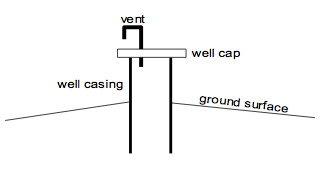
(desc) Venting.png . . 13,323 bytes . . Tcopley . . 23:23, 10 November 2012 (diagram showing the venting natural gas from a water well)
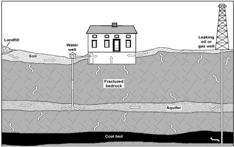
(desc) Gas mig.png.scaled500.png . . 89,967 bytes . . Tcopley . . 22:15, 7 November 2012 (Typical gas migration scenario.)
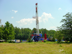
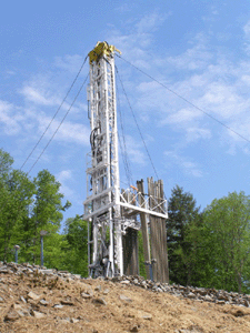
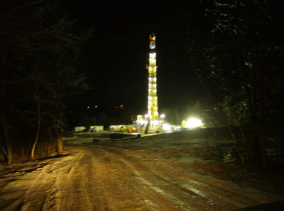
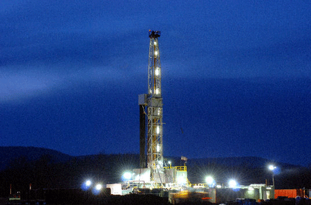
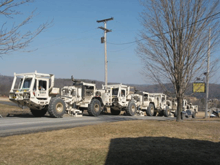
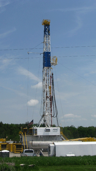
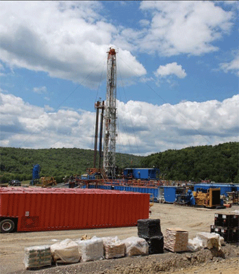
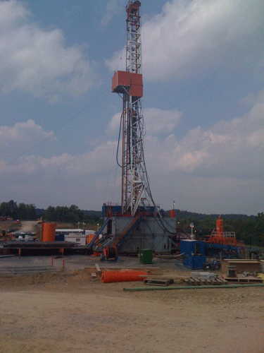
(desc) Range rig3.gif . . 85,365 bytes . . Tcopley . . 00:39, 19 February 2012 ('''Range Resources rig in Washington Co., PA'''<br>Photo credit - [http://www.gomarcellusshale.com/profile/JosephineSabillon Josephine Sabillon)
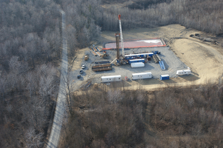
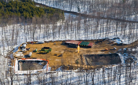
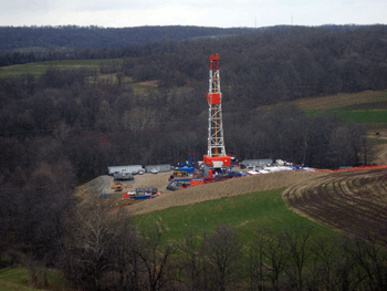
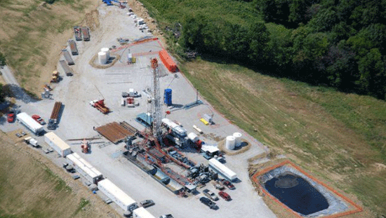
(desc) Greene site.gif . . 87,232 bytes . . Tcopley . . 22:07, 9 December 2011 (Aerial view of drilling site in Greene Co., PA. Photo courtesy of Energy Corp. of America)
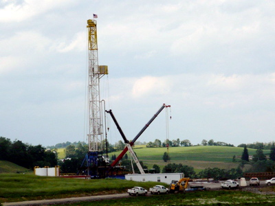
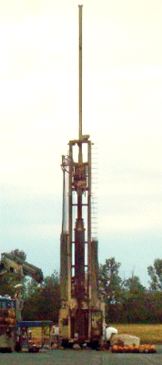
(desc) Pge rig.jpg . . 87,926 bytes . . Tcopley . . 22:03, 12 April 2011 (Pennsylvania General's first horizontal well, Potter Co, PA<br>Photo courtesy of [http://www.penngeneralenergy.com/ Pennsylvania General Corp.])
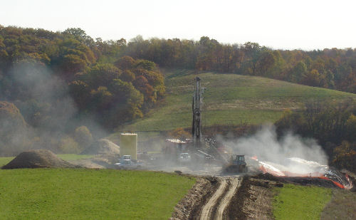
(desc) Carrizo2.gif . . 109,141 bytes . . Tcopley . . 20:08, 6 April 2011 ('''Cowfer #1 well at Osceola Mills, Centre Co., PA - 2009'''<br>Photo courtesy of [http://www.carrizo.cc/ Carrizo Oil and Gas])
(desc) Cummings.jpg . . 66,051 bytes . . Tcopley . . 02:35, 6 April 2011 ('''Cummings well site, Moffitt Hill Road, Chatham Twp., Tioga Co., PA'''<br>Photo credit: Nancy Thomas)
(desc) Cole2 wash co.jpg . . 37,673 bytes . . Tcopley . . 23:18, 22 March 2011 (Cole #2 Well in Washington Co., PA<br> Photo courtesy of [http://mountainvoilandgas.com/ Mountain V])
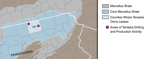
(desc) Tenaska pa map.gif . . 32,686 bytes . . Tcopley . . 22:19, 13 March 2011 (Map depicting Tenaska's holdings in northeastern Pennsylvania<br>Map Courtesy of [http://www.tenaska.com/ Tenaska].)
(desc) Tenaska wv map.gif . . 58,498 bytes . . Tcopley . . 22:09, 13 March 2011 (Map showing Tenaska's operations in northern West Virginia<br>Map courtesy of [http://www.tenaska.com/ Tenaska]. )
(desc) Roughnecks.gif . . 98,355 bytes . . Tcopley . . 01:19, 11 March 2011 (Roughnecks at work on BLX well site<br>Photo courtesy of [http://blxinc.net/ BLX Inc.])
(desc) Rig truck.gif . . 109,119 bytes . . Tcopley . . 01:14, 11 March 2011 (BLX crew tarps engine area of RD20 drill rig<br>Photo courtesy of [http://blxinc.net/ BLX Inc.])
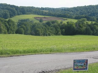
(desc) Well pad.gif . . 50,871 bytes . . Tcopley . . 20:04, 9 March 2011 (Well pad cleared near Springville, PA<br>Courtesy of Peter Comly, [http://clodhopperfarm.blogspot.com/ - ''Clodhopper Farm''])
(desc) Teel well.gif . . 46,521 bytes . . Tcopley . . 20:01, 9 March 2011 (Cabot Teel well site, Susquehanna Co., PA<br> - Photo credit - [http://www.rlstore.com Marcellus Shale in Pennsylvania - Gas Well Locations])
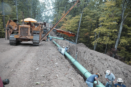
(desc) Eureka pipeline.gif . . 116,967 bytes . . Tcopley . . 21:08, 7 March 2011 (Eureka Hunter Pipeline under construction in West Virginia<br>Photo courtesy of [http://www.magnumhunterresources.com/ Magnum Hunter Resource Corp].)
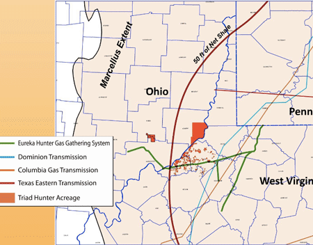
(desc) Eureka ppl map.gif . . 60,983 bytes . . Tcopley . . 21:05, 7 March 2011 (Map of ''Eureka Hunter Pipeline''<br>Map courtesy of [http://www.magnumhunterresources.com/ Magnum Hunter Resource Corp].)
(desc) Weese rig.gif . . 63,121 bytes . . Tcopley . . 21:02, 7 March 2011 (Magnum Hunter rig on Weese farm in Tyler Co., WV<br>Photo courtesy of [http://www.magnumhunterresources.com/ Magnum Hunter Resource Corp])
(desc) Magnum map.gif . . 83,911 bytes . . Tcopley . . 20:59, 7 March 2011 (Map of Magnum Hunter Appalachian leasehold<br>Map courtesy of [http://www.magnumhunterresources.com/ Magnum Hunter Resource Corp.])
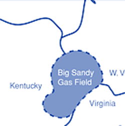
(desc) Big sandy2.gif . . 14,134 bytes . . Tcopley . . 21:09, 5 March 2011 (<div align="center">Map of '''Big Sandy Natural Gas Field'''<br>Map courtesy of [http://www.blueflameenergy.com/ Blue Flame Energy Corp]</div>)
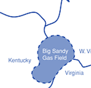
(desc) Big sandy.gif . . 22,435 bytes . . Tcopley . . 20:53, 5 March 2011 (Map of '''Big Sandy Natural Gas Field'''<br>Map courtesy of [http://www.blueflameenergy.com/ Blue Flame Energy Corp])
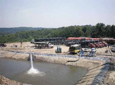
(desc) Reservoir.gif . . 78,114 bytes . . Tcopley . . 20:06, 3 March 2011 (Marcellus frac fresh water impoundment in Greene Co., Pennsylvania.<br>[http://www.energycorporationofamerica.com/ Photo courtesy of Energy Corp. of America])
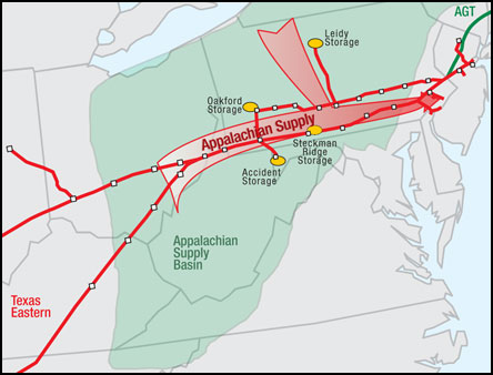
(desc) Spectra.jpg . . 33,700 bytes . . Tcopley . . 19:29, 17 February 2011 (Map of Spectra Energy's TEAM Expansion Program. Compliments of [-Spectra Energy http://www.spectraenergy.com/])
(desc) Sw appy rig.gif . . 75,994 bytes . . Tcopley . . 04:21, 9 February 2011 (Southwestern Energy Marcellus shale drilling rig back-dropped by fall Appalachian colors. Photo courtesy of [http://www.swn.com/ Southwestern Energy].)
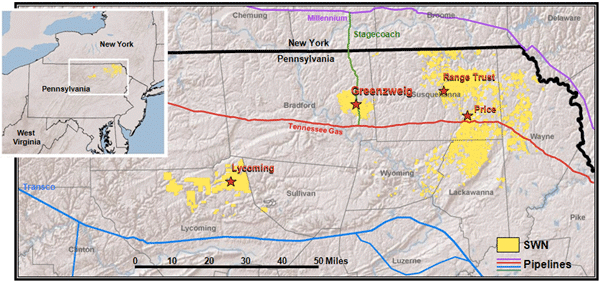
(desc) Swestern map.gif . . 126,317 bytes . . Tcopley . . 04:17, 9 February 2011 (Map of Southwestern Energy's areas of Marcellus shale operations. Map compliments of [http://www.swn.com/ Southwestern Energy].)
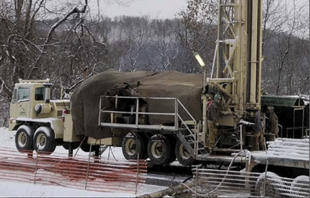
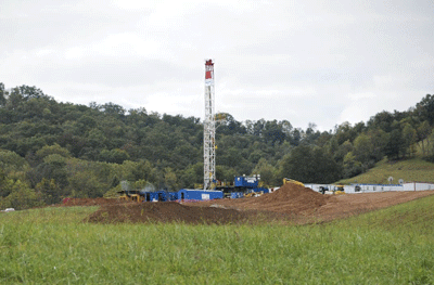
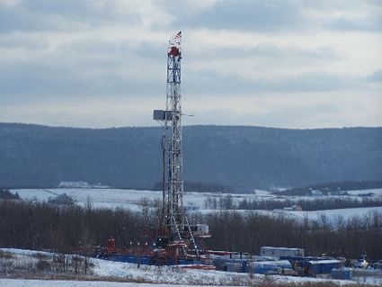
(desc) Horiz rig.gif . . 85,763 bytes . . Tcopley . . 03:02, 27 January 2011 (Horizontal Drilling Rig - Greene Co., PA Photo courtesy of [http://www.energycorporationofamerica.com/ Energy Corp. of America].)
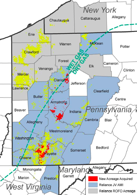
(desc) Atlas map.png . . 362,640 bytes . . Tcopley . . 09:10, 24 January 2011 ( Map depicting coverage of the 2010 Reliance Industries joint venture. Map courtesy of Atlas Energy.)
(desc) Jennings well.gif . . 68,740 bytes . . Tcopley . . 23:53, 15 January 2011 ('''Jennings well site, 2009, West Burlington Twp., Bradford Co., PA. '''- Photo credit - [http://www.rlstore.com Marcellus Shale in Pennsylvania - Gas Well Locations])
(desc) Harper.gif . . 94,343 bytes . . Tcopley . . 23:48, 15 January 2011 ('''Harper well site, 2008, West Burlington Twp., Bradford Co., PA. ''' - Photo credit - [http://www.rlstore.com Marcellus Shale in Pennsylvania - Gas Well Locations])
(desc) Black well.gif . . 82,670 bytes . . Tcopley . . 23:42, 15 January 2011 ('''Black well site, 2009, Burlington Twp., Bradford Co., PA'''. - Photo credit - [http://www.rlstore.com Marcellus Shale in Pennsylvania - Gas Well Locations])
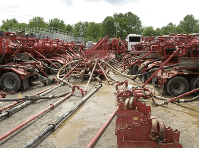
(desc) Missle.gif . . 90,734 bytes . . Tcopley . . 00:17, 7 January 2011 ('''Pump Trucks and “Missile” on Frac Job In Greene Co., PA'''. [http://www.energycorporationofamerica.com/ Photo courtesy of Energy Corp. of America])
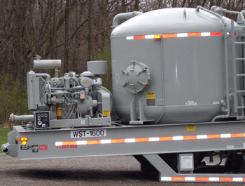
(desc) Halliburton skid sm.gif . . 78,693 bytes . . Tcopley . . 23:18, 6 January 2011 ('''Halliburton frac fluid trailer left along side highway near the Borough<br>of Houston, Washington County, PA'''<br>[http://donnan.com/ Photo credit - donnan.com])
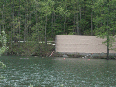
(desc) Franklin-Lake3.gif . . 112,972 bytes . . Tcopley . . 22:44, 6 January 2011 ('''Fresh water being withdrawn from small lake in Washington Co., PA to fracture well. White pipes emerging from behind blind lead to a staging area 2 mi. away. Photo credit - [http://www.gomarcellusshale.com/profile/JosephineSabillon Josephine Sabillon])
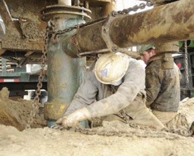
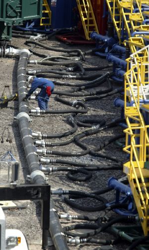
(desc) Frac.jpg . . 48,596 bytes . . Tcopley . . 22:16, 6 January 2011 ('''Worker adjusting water line used in hydro-fracturing''' a Marcellus well in Dimock Township, Susquehanna County, PA. Courtesy of Michael J. Mullen, Staff Photographer, ''Scranton Times-Tribune''[http://www.thetimes-tribune.com/])
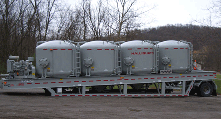
(desc) Frac chem tank sm.gif . . 71,645 bytes . . Tcopley . . 19:26, 6 January 2011 ('''Halliburton frac fluid tank'''. Photo credit -[http://donnan.com/ donnan.com])
(desc) Foustwellgranville.gif . . 74,169 bytes . . Tcopley . . 21:41, 11 December 2010 (Foust well site, 2008, Granville Twp., Bradford Co., PA. [http://www.rlstore.com - Photo credit - Marcellus Shale in Pennsylvania - Gas Well Locations])
(desc) Talisman map.gif . . 41,986 bytes . . Tcopley . . 21:40, 11 December 2010 (Map depicting Talisman's area of operations in south central NY State and in northeastern PA. Map courtesy of: [http://www.talisman-energy.com/ Talisman Energy Inc.])
(desc) Holbrook1.jpg . . 49,572 bytes . . Tcopley . . 19:18, 30 November 2010 (Alta Holbrook #1 - Laurel Lake, Susquehanna Co., PA. [http://naturalgas.extension.psu.edu/ Photo credit - Dave Messersmith, Penn State Cooperative Extension])
(desc) Microseismic marcellus ESG2.png . . 94,226 bytes . . Kmountjoy . . 16:02, 23 November 2010 (Example of microseismic analysis of a dual-well hydraulic fracture in the Marcellus shale.)
(desc) Dual well microseismic SRV.png . . 141,422 bytes . . Kmountjoy . . 15:47, 23 November 2010 (Example of microseismic monitoring for a dual-well hydraulic fracture showing stimulated reservoir volume)
(desc) Microseismic Marcellus ESG.png . . 152,262 bytes . . Kmountjoy . . 20:42, 22 November 2010 (Microseismic monitoring of a horizontal dual-well hydraulic fracture in the Marcellus shale)
(desc) Thumper2.gif . . 52,323 bytes . . Tcopley . . 03:08, 22 November 2010 (A convoy of vibroseis trucks cruises down a country road near Springville, PA'''<br>Courtesy of Peter Comly, [http://clodhopperfarm.blogspot.com/ - ''Clodhopper Farm''])
(desc) Pioneer.gif . . 116,905 bytes . . Tcopley . . 20:46, 20 November 2010 (Petoskey Pioneer well. Courtesy of Andrea Sullivan and Andy Stempky, [http://www.michigan.gov/dnr - MDNRE].)
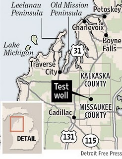
(desc) Michigan map.jpg . . 31,510 bytes . . Tcopley . . 20:42, 20 November 2010 (Location of Petoskey Collingwood/Utica shale pilot well<br>[http://www.freep.com/ - Map courtesy of Detroit Free Press])
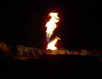
(desc) Houseknectburn.gif . . 65,386 bytes . . Tcopley . . 21:34, 18 November 2010 (Flaring Houseknect well, 2009, Springfield Twp., Bradford Co., PA. Photo credit - [http://www.rlstore.com Marcellus Shale in Pennsylvania - Gas Well Locations])
(desc) Wardwell.gif . . 93,789 bytes . . Tcopley . . 21:12, 18 November 2010 (Ward well site, 2008, Springfield Twp., Bradford Co., PA.<br>- Photo credit - [http://www.rlstore.com Marcellus Shale in Pennsylvania - Gas Well Locations])
(desc) Houseknectburn.jpg . . 26,876 bytes . . Tcopley . . 20:47, 18 November 2010 (Flaring Houseknect well, 2009, Springfield Twp., Bradford Co., PA. Photo credit - [http://www.rlstore.com Marcellus Shale in Pennsylvania - Gas Well Locations])
(desc) Wardwell.jpg . . 147,915 bytes . . Tcopley . . 02:17, 18 November 2010 (Ward well site, 2008, Springfield Twp., Bradford Co., PA.<br>- Photo credit - [http://www.rlstore.com Marcellus Shale in Pennsylvania - Gas Well Locations])
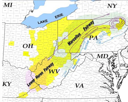
(desc) Huron sm.gif . . 110,178 bytes . . Tcopley . . 01:03, 12 November 2010 (Huron shale map. Courtesy of EXCO Resources.)
(desc) PD-icon.gif . . 4,028 bytes . . Tcopley . . 21:49, 9 November 2010 (From [http://commons.wikimedia.org/wiki/File:PD-icon.svg Wikipedia Commons])
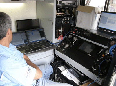
(desc) Microseismic.gif . . 82,400 bytes . . Tcopley . . 22:45, 4 November 2010 (On board a microseismic logging truck in Greene Co., PA. Photo courtesy of [http://www.energycorporationofamerica.com/ Energy Corp. of America])
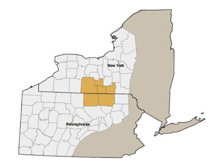
(desc) Norse map.gif . . 48,946 bytes . . Tcopley . . 21:21, 2 November 2010 (N.Y. map courtesy Norse Energy)
(desc) Norse map legend.gif . . 20,546 bytes . . Tcopley . . 21:01, 2 November 2010 (Map legend that goes with NY Map. Courtesy of Norse Energy.)
(desc) Norse rig.gif . . 83,896 bytes . . Tcopley . . 20:58, 2 November 2010 (N.Y. map courtesy Norse Energy)
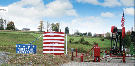
(desc) Penneco.gif . . 67,402 bytes . . Tcopley . . 22:28, 31 October 2010 (Old Glory. [http://www.penneco.com/ Photo courtesy of Penneco Oil Company])
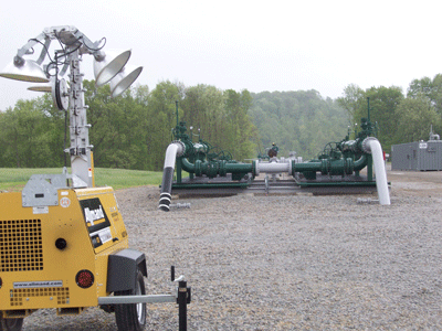
(desc) MarkWest compress.gif . . 80,431 bytes . . Tcopley . . 20:42, 31 October 2010 (Gas transmission lines disappear underground in Washington Co., PA. Photo credit - [http://www.gomarcellusshale.com/profile/JosephineSabillon Josephine Sabillon])
(desc) MarkWest-Compress2.gif . . 75,259 bytes . . Tcopley . . 20:39, 31 October 2010 (MarkWest Liberty compressor station in Washington Co., PA. Photo credit - [http://www.gomarcellusshale.com/profile/JosephineSabillon Josephine Sabillon])
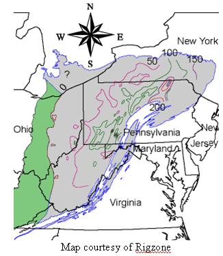
(desc) Marcel.JPG . . 27,637 bytes . . Tcopley . . 19:38, 31 October 2010 (Map showing extent of the Marcellus shale formation. Map courtesy of [http://www.rigzone.com// Rigzone])
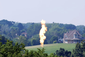
(desc) Hickory flare.gif . . 41,657 bytes . . Tcopley . . 18:05, 29 October 2010 (Range Resources' well in suburban area being flared after hydro-fracturing. Photo credit [http://www.marcellus-shale.us -www.marcellus-shale.us])
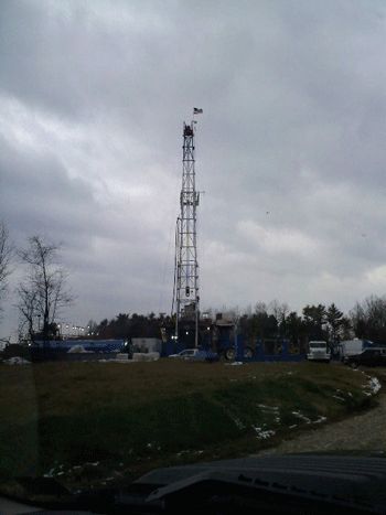
(desc) Rrc rig.gif . . 51,284 bytes . . Tcopley . . 17:48, 29 October 2010 (Appalachian fall colors backdrop Range rig. Image courtesy of Range Resources.)
(desc) Washington co rig sm.gif . . 58,644 bytes . . Tcopley . . 17:34, 29 October 2010 (Drilling rig in rural Washington Co., PA [http://donnan.com/ Photo credit - donnan.com])
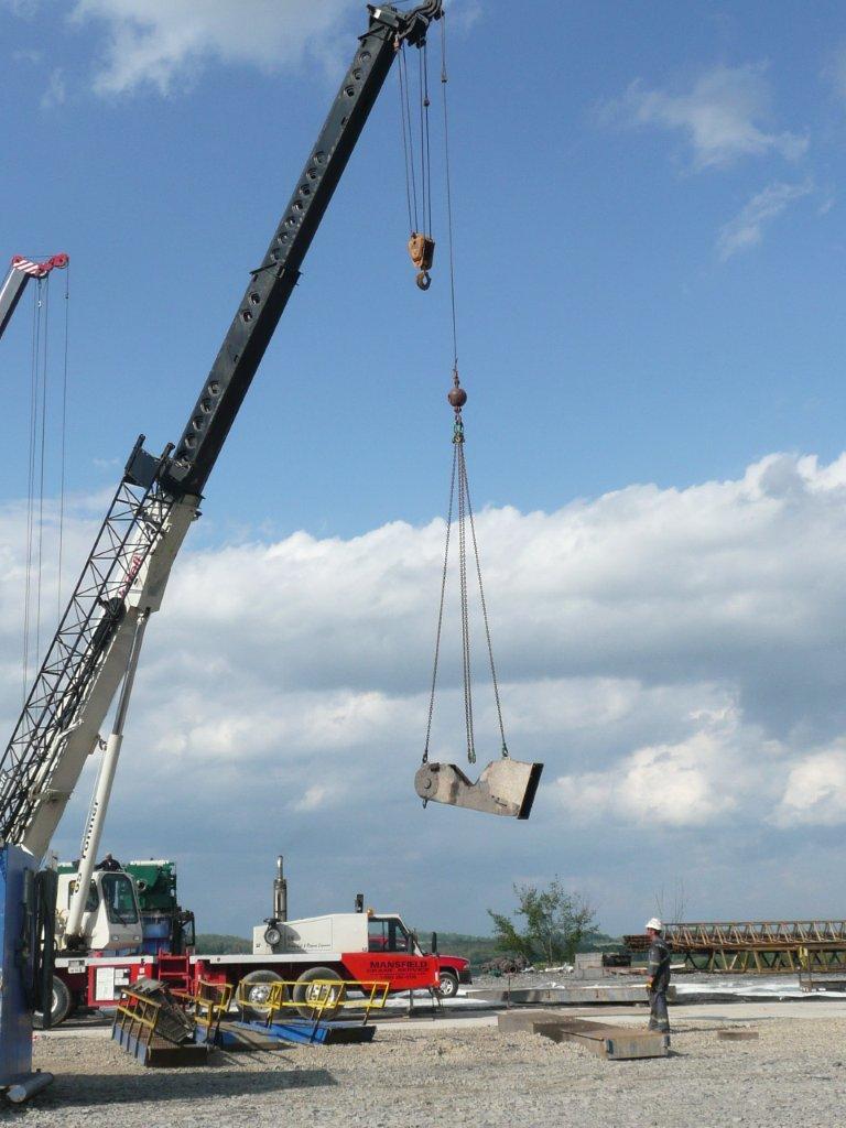
(desc) Pipe.gif . . 108,110 bytes . . Tcopley . . 01:51, 18 October 2010 (Roughnecks preparing well site. Photo courtesy of CONSOL Energy Inc.)
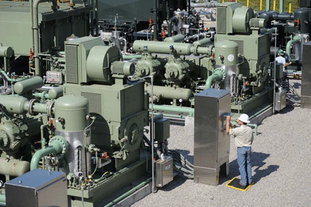
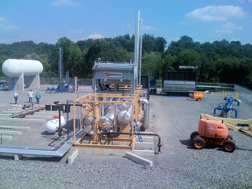
(desc) Gas processing.gif . . 110,950 bytes . . Tcopley . . 01:48, 18 October 2010 (CONSOL Energy gas processing plant. Photo courtesy of CONSOL Energy Inc.)
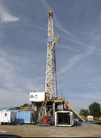
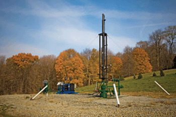
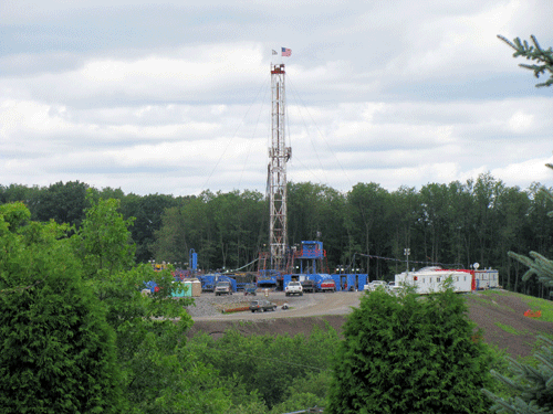
(desc) Drilling rig.gif . . 133,906 bytes . . Tcopley . . 02:26, 17 October 2010 (CONSOL/CNX Marcellus shale drilling rig - Photo courtesy of CNX Gas Corporation)
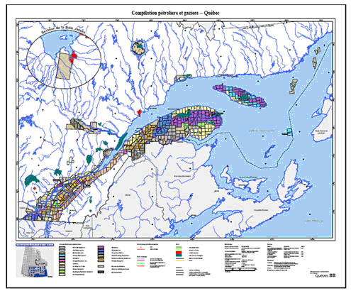
(desc) Sl-lowlands.gif . . 80,808 bytes . . Tcopley . . 19:26, 16 October 2010 (Saint Lawrence Lowlands showing prospective areas. Map courtesy of the governement of Quebec.)
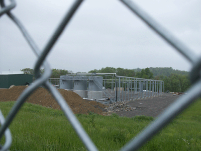
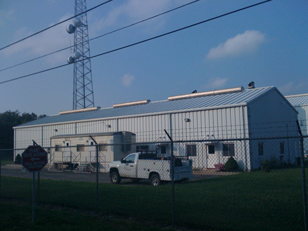
(desc) Jos07.gif . . 103,391 bytes . . Tcopley . . 19:04, 13 October 2010 (EQT Corp. pre-engineered steel structure that houses compressor stations once built. Located near the Borough of Waynesburg in Greene Co., PA about 60 miles southwest of Pittsburgh. Photo credit Josephine Sabillon.)
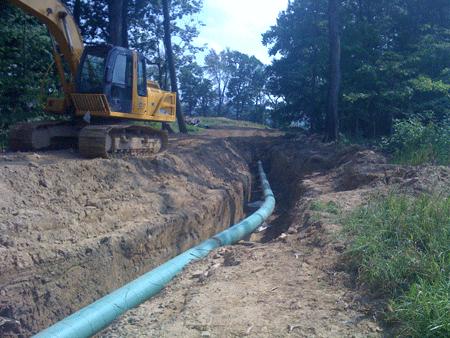
(desc) Jos06.gif . . 128,899 bytes . . Tcopley . . 19:02, 13 October 2010 (Active EQT Corp. pipeline project that is running next to a completed well head (there is a huge frac evaporation and chyrstalization pond next to it). This location is near the Borough of Waynesburg in Greene Co., PA about 60 miles so)
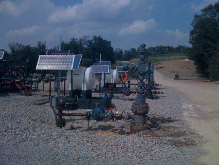
(desc) Jps05.gif . . 122,500 bytes . . Tcopley . . 19:01, 13 October 2010 (Completed EQT Corp. well head and solar operated telemetry unit located near the Borough of Waynesburg in Greene Co., PA about 60 miles southwest of Pittsburgh. Photo credit Josephine Sabillon. )
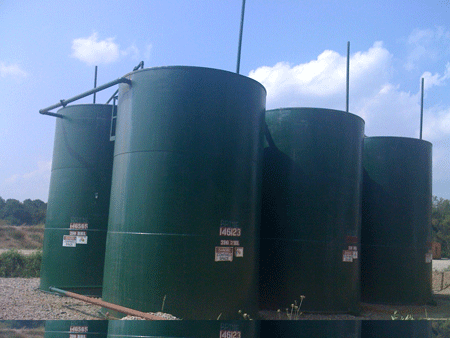
(desc) Jos4.gif . . 89,884 bytes . . Tcopley . . 18:57, 13 October 2010 (Brine water tanks (collect residual frac water as it returns to the surface over time). EQT Corp. drilling site located near the Borough of Waynesburg in Greene Co., PA about 60 miles southwest of Pittsburgh. Photo credit Josephine Sab)
(desc) Jos03.gif . . 98,374 bytes . . Tcopley . . 18:56, 13 October 2010 (Vent stacks for new EQT Corp. compressor station located near the Borough of Waynesburg in Greene Co., PA about 60 miles southwest of Pittsburgh. Photo credit Josephine Sabillon.)
(desc) Jos02.gif . . 111,154 bytes . . Tcopley . . 18:17, 13 October 2010 (EQT Corp. drilling rig (next to the compressor station that was the first picture taken). This rig is located near the Borough of Waynesburg in Greene Co., PA about 60 miles southwest of Pittsburgh. Photo credit Josephine Sabillon.)
(desc) Jos01.gif . . 106,032 bytes . . Tcopley . . 18:16, 13 October 2010 (Compressor, EQT Corp. compressor station, located near the Borough of Waynesburg in Greene Co., PA about 60 miles southwest of Pittsburgh. Photo credit Josephine Sabillon.)
(desc) Ohio wells.gif . . 51,077 bytes . . Tcopley . . 00:42, 24 September 2010 (Ohio Marcellus shale wells as of June, 2010. Map courtesy of the Ohio Geological Survey.)
(desc) EXCO skyline.GIF . . 37,448 bytes . . Tcopley . . 01:55, 23 September 2010 (EXCO rig, 2009, Skyline Golf Course on Route 247, Greenfield Twp in Lackawanna Co., PA. Photo credit -Robin Scala.)
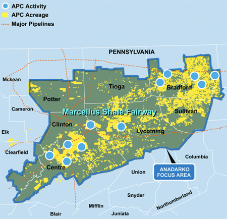
(desc) Anadarko map.gif . . 94,987 bytes . . Tcopley . . 02:00, 22 September 2010 (Anadarko's focus area in central and northeast Pennsylvania. Map courtesy of Anadarko Petroleum Corp.)
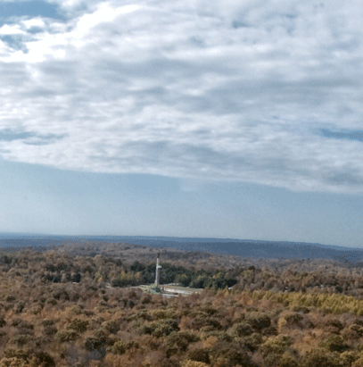
(desc) Anadarko rig.gif . . 98,617 bytes . . Tcopley . . 01:58, 22 September 2010 (Anadarko drilling rig in an Appalachian forest. Photo courtesy of Anadarko Petroleum Corp.)
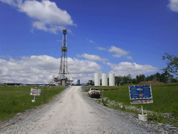
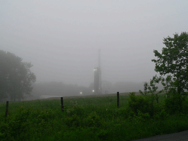
(desc) Te rig2.gif . . 89,528 bytes . . Tcopley . . 03:12, 9 September 2010 (Hilltop drilling location in Northern West Virginia. Photo courtesy of Trans Energy Inc.)
(desc) Te rig.gif . . 118,553 bytes . . Tcopley . . 03:09, 9 September 2010 (Trans Energy drilling rig in Northern Panhandle of West Virginia. Photo courtesy of Trans Energy Inc.)
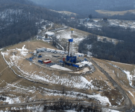
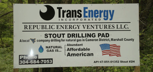
(desc) Stout.gif . . 82,397 bytes . . Tcopley . . 03:06, 9 September 2010 (Stout well site, Marshall Co., WV. Photo courtesy of Trans Energy Corp.)
(desc) Chessy rig.gif . . 55,788 bytes . . Tcopley . . 02:27, 31 August 2010 (Chesapeake well site, Susquehanna Co., PA Photo credit - Dave Messersmith, Penn State Cooperative Extension.)
(desc) Chessy rig fog.gif . . 50,088 bytes . . Tcopley . . 02:18, 31 August 2010 (Robson well site shrouded in fog, Wayne Co., PA.<br> Photo credit - Dave Messersmith, Penn State Cooperative Extension.)
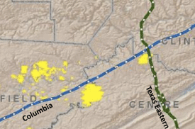
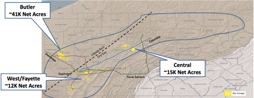
(desc) Rex clearfield map.gif . . 47,708 bytes . . Tcopley . . 21:16, 24 August 2010 (Central PA Project Area - 15,400 net acres- 50% Company-owned WI)
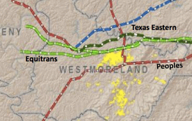
(desc) Rex westmoreland map.gif . . 40,256 bytes . . Tcopley . . 21:13, 24 August 2010 (Westmoreland Project Area - 11,700 net acres- 50% Company-owned WI)
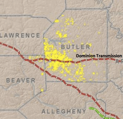
(desc) Rex butler map.gif . . 52,594 bytes . . Tcopley . . 21:11, 24 August 2010 (Butler Project Area - 40,800 net acres 100% Company-owned working interest (WI))
(desc) Rex ops map.gif . . 71,889 bytes . . Tcopley . . 20:56, 24 August 2010 (Rex Energy Marcellus shale operations mid-2010)
(desc) Knauf well.gif . . 117,150 bytes . . Tcopley . . 20:33, 24 August 2010 (P. Knauf #1H, the first horizontal well drilled in Butler County. This photo shows the well site one year after being completed and put inline. Credit: Julia Williams, Rex Energy Corp.)
(desc) Shannon wells.gif . . 111,828 bytes . . Tcopley . . 20:17, 24 August 2010 (Rex's Union drilling rig on the Shannon 1H & 2H drill pad in Butler County, PA. Photo taken at the end of June, 2010 by Julia Williams, Rex Energy Corp. )
(desc) Refrig plant.gif . . 141,087 bytes . . Tcopley . . 20:00, 24 August 2010 (Butler County refrigeration plant shot summer '09 shortly after it became operational. Photo credit: Julia Williams, Rex Energy Corporation.)
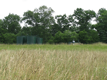
(desc) 6-16-2010 5 PM (41).jpg . . 99,441 bytes . . Tcopley . . 00:23, 27 July 2010 (Nancy Thomas photo - test)


![<div align="center">Map of '''Big Sandy Natural Gas Field'''<br>Map courtesy of [http://www.blueflameenergy.com/ Blue Flame Energy Corp]</div>](/wiki/index.php/Image:Big_sandy.gif)