Huron shale
From Wikimarcellus
(Difference between revisions)
| Revision as of 04:33, 10 April 2009 Tcopley (Talk | contribs) (added map image) ← Previous diff |
Revision as of 04:34, 10 April 2009 Tcopley (Talk | contribs) Next diff → |
||
| Line 1: | Line 1: | ||
| - | <center>http://www.sonic.net/~tcopley/img/huron_fairway.jpg<br>Source: [[EXCO Resoures]]</center> | + | <center>http://www.sonic.net/~tcopley/img/huron_fairway.jpg<br>Source: [[EXCO Resoures, Inc]]</center> |
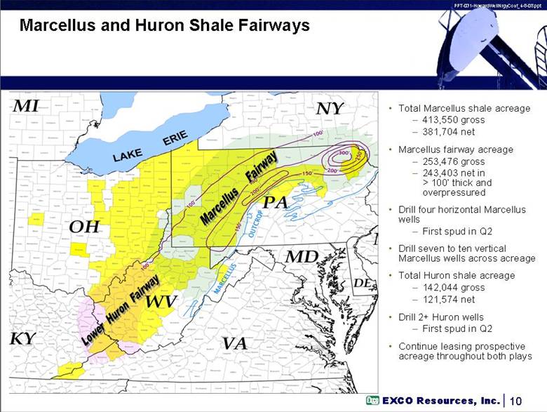
| The '''Huron shale''' is a play spanning the tri-state area of Southern [[West Virginia]], Eastern Kentucky and Western Virginia. It is shallower than the [[Marcellus shale]] at the 4000 or 5000 feet level. Most of the wells in this formation are [[Horizontal drilling|horizontal]] ones. | The '''Huron shale''' is a play spanning the tri-state area of Southern [[West Virginia]], Eastern Kentucky and Western Virginia. It is shallower than the [[Marcellus shale]] at the 4000 or 5000 feet level. Most of the wells in this formation are [[Horizontal drilling|horizontal]] ones. | ||
Revision as of 04:34, 10 April 2009
The Huron shale is a play spanning the tri-state area of Southern West Virginia, Eastern Kentucky and Western Virginia. It is shallower than the Marcellus shale at the 4000 or 5000 feet level. Most of the wells in this formation are horizontal ones.


